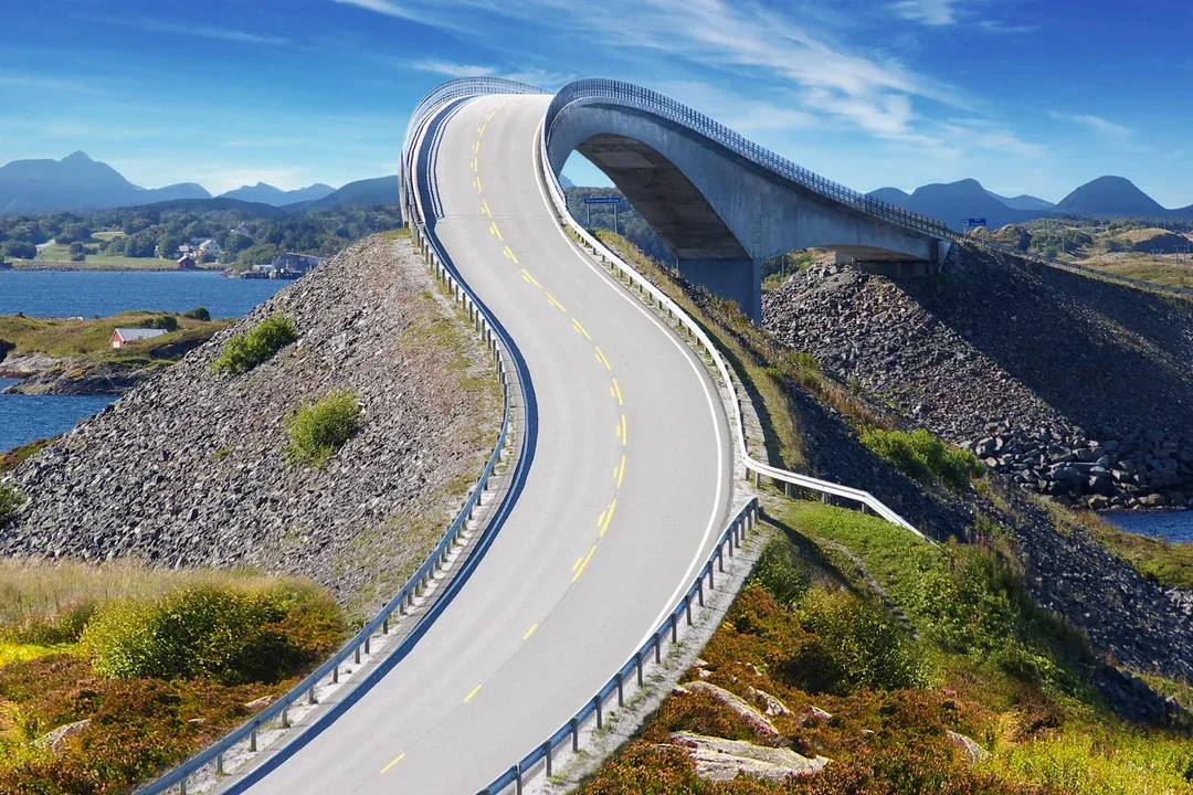
Storseisundet Bridge
The longest and most prominent bridge on the route, noted for its curved design that creates an optical illusion from certain angles.
Visit the viewing area nearby for a clear perspective of the span.

The Atlantic Ocean Road runs open day and night across eight bridges and 8.3 kilometers of exposed coastline between Averøy and the mainland. This guide covers access hours, weather windows, and how to time your drive along one of Norway's most dramatic National Tourist Routes.
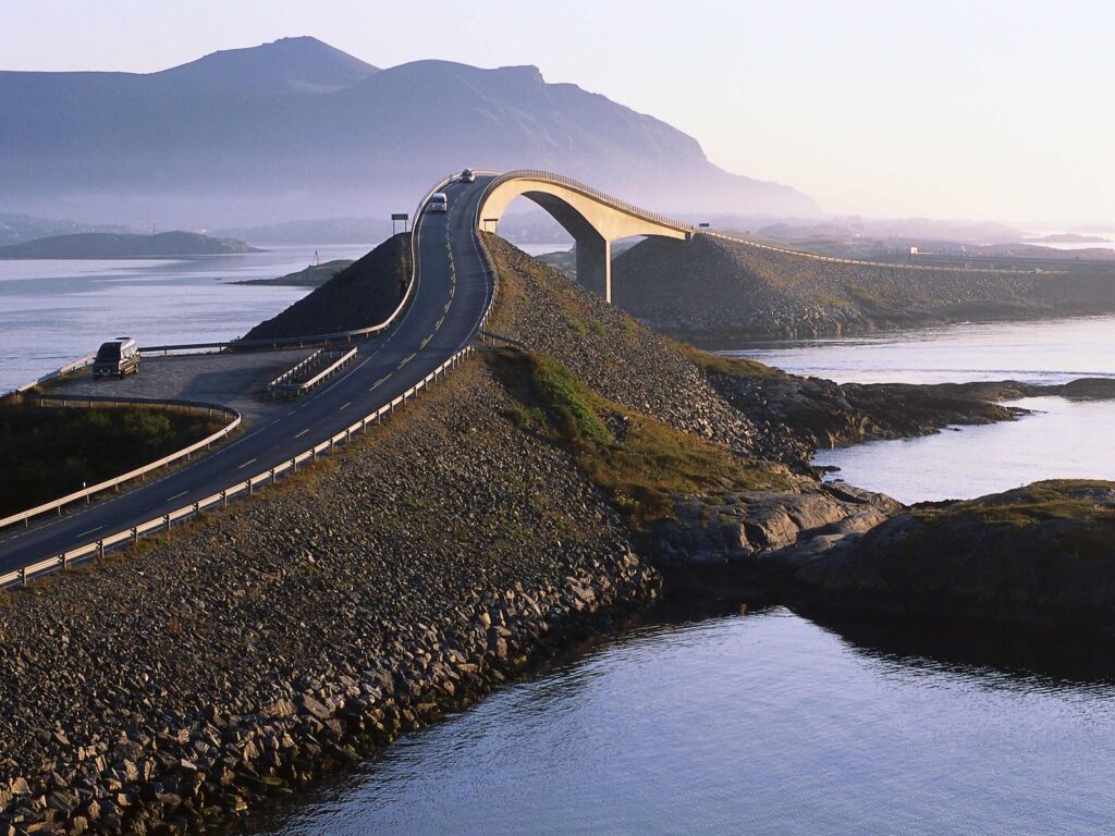
Quick answer
The Atlantic Ocean Road is open 24 hours a day, seven days a week, with no entrance fee. The route is a public highway (County Road 64) maintained year-round, though driving conditions depend heavily on weather—high winds and storm surges can make the road impassable during autumn and winter. Visit outside peak daylight hours to avoid tour buses and summer traffic.
The Atlantic Ocean Road carries fewer than fifty permanent residents but sees more than a quarter-million visitors each year, most of them driving the 8.3-kilometer stretch in under ten minutes. That brevity is deceptive. The road opened in 1989 after six years of construction interrupted twelve times by Atlantic storms, and the forces that delayed its completion remain the primary variable in any visit today. Wind speed, wave height, and tidal timing determine whether you cross in calm sunlight or through salt spray thrown thirty meters above the roadway. The route belongs to Norway's National Tourist Routes program, which means the infrastructure—viewpoints, rest areas, architectural shelters—has been designed for stops, not speed. The Storseisundet Bridge, the highest and most photographed of the eight spans, appears to drop off into open water when approached from the northeast, an optical effect that holds only from one angle and disappears as you cross. Two formal viewing platforms anchor the route: one at the southern end near Eldhusøya, the other midway at the Atlantic Road Museum. Both are elevated, railed, and positioned to frame the bridges against the archipelago rather than the road itself. Weather determines the character of the drive more than season does. Summer brings long daylight and relative calm, but also coaches and rental campers queued at the pullouts. Autumn and winter push the Atlantic onto the road itself, with waves breaking over the guardrails during storm cycles and salt glaze freezing across the asphalt. The road remains open unless the Norwegian Public Roads Administration issues a closure, which happens several times each winter when wind gusts exceed twenty-five meters per second. Real-time conditions are posted on the Statens Vegvesen travel information service, which also tracks road temperature and precipitation. The atlantic ocean road molde norway lies seventeen kilometers west of Averøy's main settlement and thirty-five kilometers from Molde via the subsea Atlanterhavstunnelen. Most visitors approach from the east, crossing the tunnel and continuing along County Road 64 through Bremsnes and Vevang before reaching the ocean section. The road is narrow by highway standards—two lanes with minimal shoulder—and parking is limited to the designated viewpoints. Stopping on the roadway itself is prohibited and, during high wind, dangerous.
“The road opened in 1989 after six years of construction interrupted twelve times by Atlantic storms, and the forces that delayed its completion remain the primary variable in any visit today.”
The Atlantic Ocean Road is located on the coast of Averøy, approximately 50 kilometers north of Molde. The most direct approach is by personal or rental vehicle, allowing for flexibility along the route.
Road 64 toward Averøy
Route 420 from Molde to Bud/Averøy
Direct transfer from Molde city center
Visitors driving from Molde should follow Road 64, which connects directly to the Atlantic Ocean Road via the Atlanterhavsvegen bridge system. Parking is available at designated pull-off areas along the route.
The Atlantic Ocean Road is a public thoroughfare and remains accessible to travelers at all times. It is open every day of the week, twenty-four hours a day.
The Atlantic Ocean Road is accessible year-round, but late spring and early autumn provide the most favorable balance of manageable traffic and stable conditions. Visiting outside of peak mid-day hours helps avoid the highest concentration of tour buses.
Mild, 8°C to 15°C; longer daylight hours.
Longer days allow for flexible planning. Many travelers prefer this time for road conditions.
Cool, 5°C to 12°C; increased wind risk.
Weather becomes unpredictable, but crowds dissipate significantly. This period is suitable for those seeking solitude.
—
Arriving before 10:00 provides the best opportunity to experience the road without congestion. This timing ensures quieter stops at the bridges.
Verdict: The best time to visit is on weekday mornings during May, June, September, or October to balance crowd levels with daylight availability.
The Atlantic Ocean Road features a series of eight bridges connecting the islands between Molde and Kristiansund. These structures and the associated rest areas provide opportunities to observe the interplay between engineering and the coastal environment.
The longest and most prominent bridge on the route, noted for its curved design that creates an optical illusion from certain angles.
Visit the viewing area nearby for a clear perspective of the span.
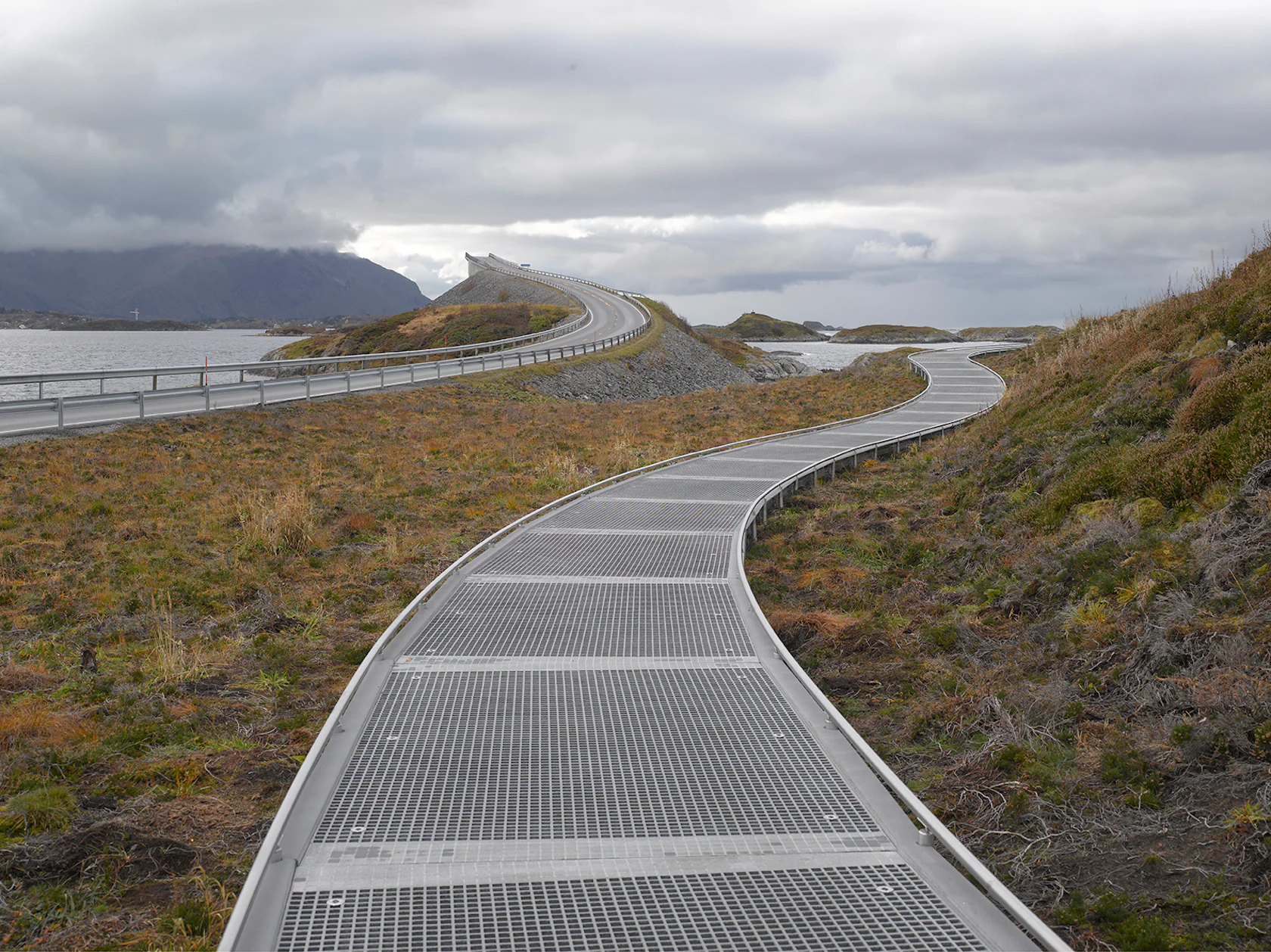
A designated rest area featuring a raised, circular steel walkway that provides accessible views of the surrounding archipelago.
Walk the full path to see the ocean terrain from all sides.
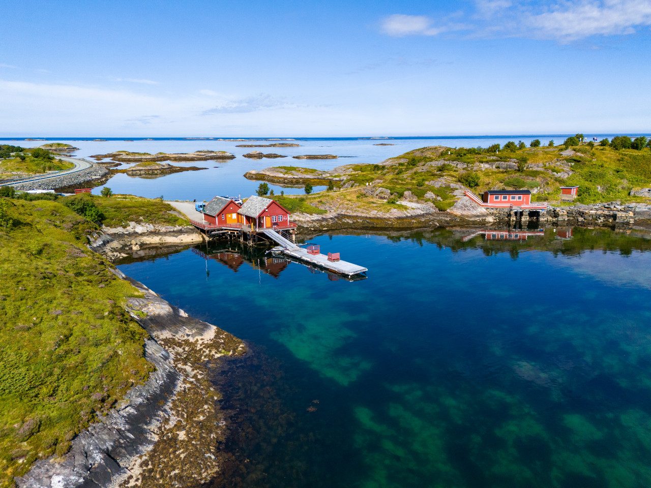
This island serves as a primary hub for fishing and offers proximity to the rugged, low-lying coastal rocks.
Check the designated pathways to see local marine vessels and rock formations.
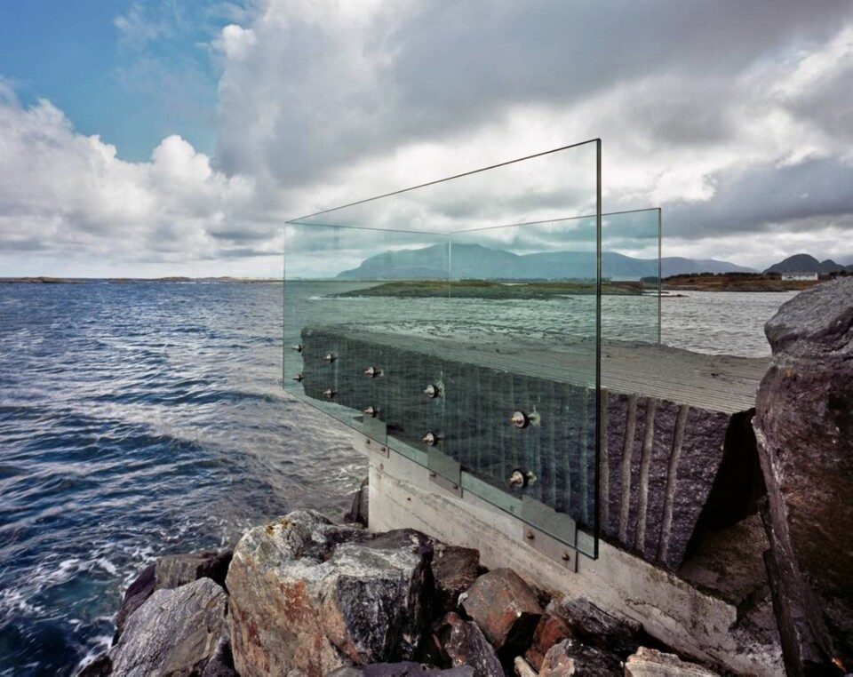
A resting point with a specialized glass viewing pavilion designed to offer shelter while maintaining views of the sea.
Look through the glass walls to watch waves during high tides.
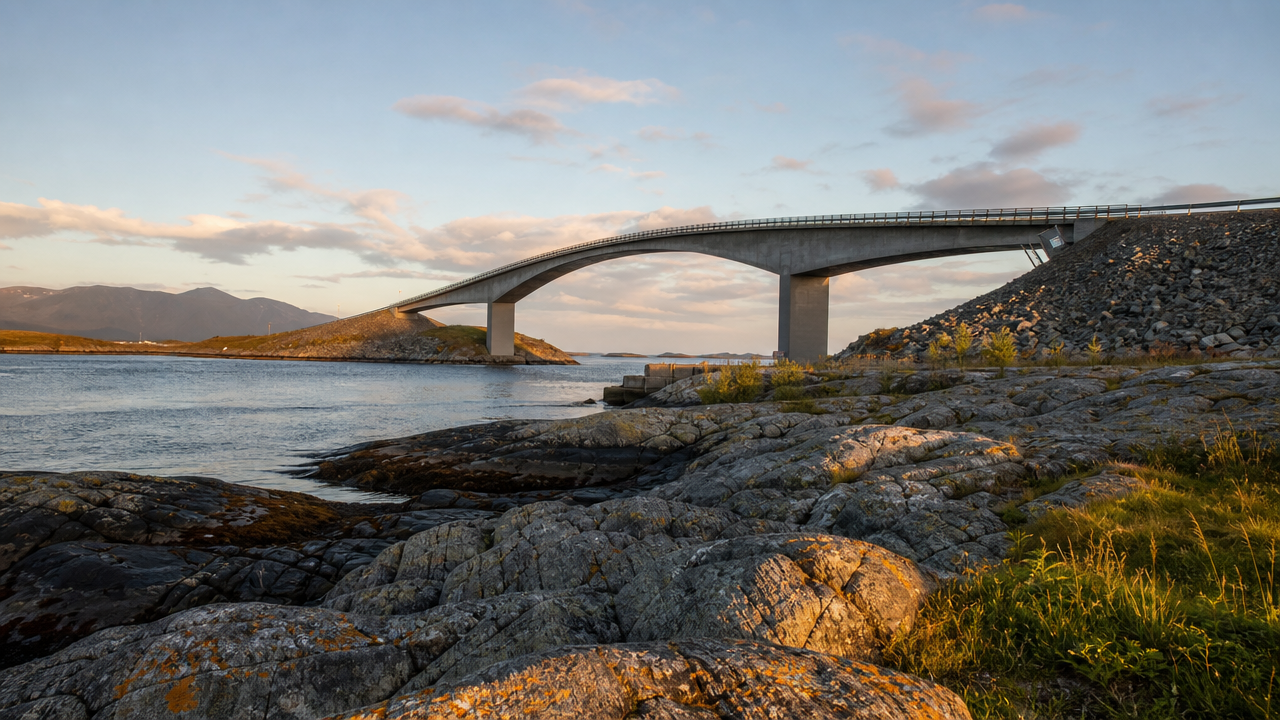
Clear weather, mid-morning
Park at the designated area near the bridge to capture the dramatic curve from a lower angle.
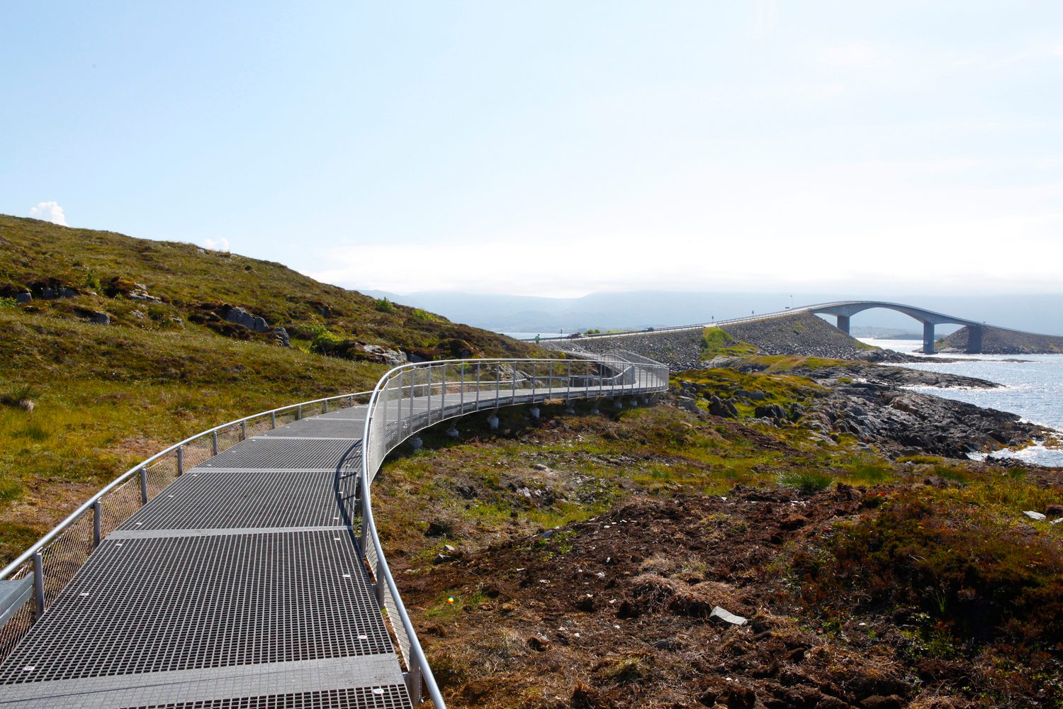
Golden hour
Walk the circular path for elevated perspectives of the bridge and the rugged coastline.
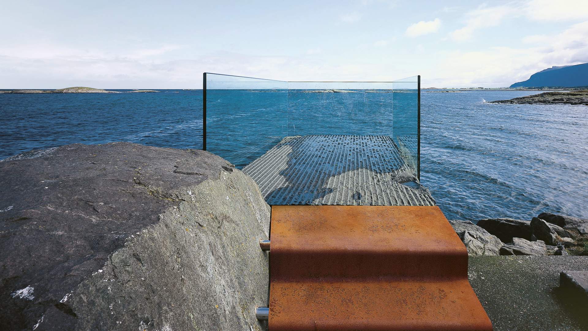
Low tide
Located at the end of a breakwater, this spot offers panoramic vistas of the ocean and concrete structures.
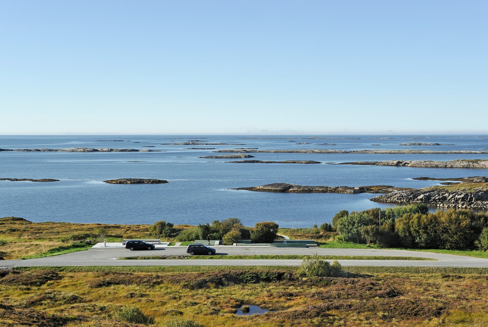
Late afternoon
A pull-off area providing a wide view of the archipelago and the road connecting the islands.
Dining options along the Atlantic Ocean Road are primarily clustered in Averøy, offering a mix of established eateries and opportunities for self-catering. Visitors will find local fare ranging from casual cafes to restaurants, though planning ahead is recommended due to limited service density.
restaurant
Located on an island accessible by boat near the route, this venue specializes in traditional coastal cuisine in a historic setting.
café
Situated directly on the route, this spot provides light meals and coffee with views of the surrounding archipelago.
market
Several small grocery shops in the town of Averøy offer supplies for those preferring to pack their own food.
picnic
Designated rest stops along the road provide tables and accessible terrain for visitors carrying their own meals.
Everything you need to know about atlantic ocean road molde norway
There is no entrance fee for the atlantic ocean road molde norway, as it is a public road. You can access the entire route free of charge at any time.
The road is open 24/7, with operating hours from 00:00 to 23:59 every day of the week. This ensures constant accessibility for all visitors.
Yes, the road is open year-round, allowing travelers to experience the coastal landscape in various weather conditions. Please check local traffic reports during winter for potential seasonal closures due to storms.
To avoid crowds and tour buses, the recommended best arrival window is anytime, though visiting outside peak daytime hours is advised for a quieter experience. The route remains open from 00:00 to 23:59 daily.
Drivers should remain attentive to changing weather conditions and strong winds, especially on the bridges. Observe all local traffic signs and use designated parking areas to view the coastal scenery safely.
The route features several designated stops with parking, viewing platforms, and basic service areas to accommodate travelers. Visitors can find more information about these facilities via the official national tourist route website.