
Storseisundet Bridge
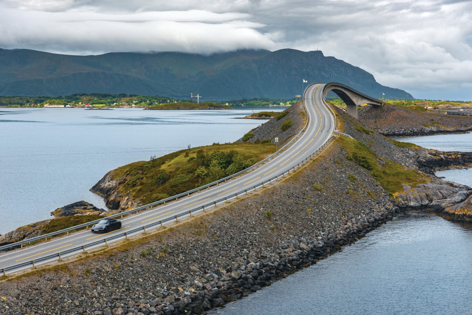
The most prominent structure on the route, this cantilever bridge features a dramatic curve that creates an optical illusion when viewed from specific angles.
View from the designated rest area south of the bridge.

The Atlantic Ocean Road is a specific 8.3-kilometer stretch of County Road 64 in Averøy Municipality, Møre og Romsdal, Norway. This guide provides the official address, regional context, and the landmarks that pinpoint its position along Norway's northwest coast.
Quick answer
The Atlantic Ocean Road is located at Atlanterhavsvegen, 6530 Averøy, Norway, spanning 8.3 kilometers of County Road 64 between the islands of Averøy and the mainland. It sits in Møre og Romsdal county on Norway's northwest coast, approximately 30 kilometers southwest of Kristiansund and accessible via the coastal highway network that connects Molde to the outer archipelago.
The Atlantic Ocean Road occupies a precise corridor in Norway's coastal geography: it runs along County Road 64 in Averøy Municipality, approximately 47 kilometers northwest of Molde and 30 kilometers southwest of Kristiansund. The official address, Atlanterhavsvegen, 6530 Averøy, marks the midpoint of the 8.3-kilometer route that threads through a chain of low-lying skerries and islets between Kårvåg on the island of Averøy and Vevang on the mainland side. Where is the Atlantic Ocean Road located within the broader Norwegian road network? It forms part of Norwegian National Tourist Route Atlanterhavsvegen, one of eighteen designated scenic highways maintained by the Norwegian Public Roads Administration. The route begins at the Vevang junction on the mainland, crosses eight bridges over open water, and terminates at Kårvåg, where it connects to the rest of Averøy's road system. Storseisundet Bridge, the longest and most photographed of the spans, marks roughly the halfway point. The road's position exposes it directly to the Norwegian Sea, with no landmass between the pavement and the Atlantic swell. Regional context matters for navigation. Averøy Municipality lies at the outer edge of the Romsdalsfjord system, where fjord water meets ocean current. The Atlantic Road itself sits on the seaward side of this threshold, which explains both its dramatic exposure and its role as a functional link in the coastal highway. Drivers approaching from Molde follow Route 64 northwest through Eide and across the Gjemnes Peninsula; those coming from Kristiansund take the subsea tunnel south to Averøy, then follow local roads west to the Kårvåg approach. The road is not isolated—it connects working communities and serves as the primary route for residents moving between Averøy's outer villages and the regional centers. The surrounding seascape is low and horizontal. No cliffs, no mountains rising from the shore—just exposed bedrock, shallow channels, and the engineered geometry of the bridges lifting the roadway above the tide. Weather systems track directly across this stretch of coast with no topographic interruption, which is why the road is frequently cited in storm documentation and why its bridges were designed with curved clearances to deflect wind and wave force. The location is as much about exposure as elevation, a ribbon of asphalt and concrete suspended over water that remains in constant motion.
“The road sits at the outer edge of the fjord system, where protected water meets the open Norwegian Sea.”
The Atlantic Ocean Road is located in Møre og Romsdal county, Norway, connecting the municipalities of Averøy and Eide. It is most easily accessed by car via County Road 64 (Fv64).
From Molde via Fv64
From Kristiansund via Fv64
From Molde to Atlanterhavsvegen
The road is a public thoroughfare and functions as an open stretch of coastal infrastructure, so no specific ticketed entrance is required. Parking is available at designated stops along the route to facilitate safe viewing of the coastline.
The Atlantic Ocean Road is a public road accessible to travelers at all times. It remains open daily throughout the year.
The Atlantic Ocean Road is a public thoroughfare and does not charge any entrance fees or tolls for vehicles. Access to the route is open to all travelers without cost.
Verdict: A typical adult pays 0 NOK to traverse the road, as there are no toll charges for any traveler.
The Atlantic Ocean Road consists of a series of eight bridges and several scenic viewpoints that connect the islands between Averøy and Eide. These structures demonstrate coastal engineering designed to withstand the forces of the Norwegian Sea.
The most prominent structure on the route, this cantilever bridge features a dramatic curve that creates an optical illusion when viewed from specific angles.
View from the designated rest area south of the bridge.
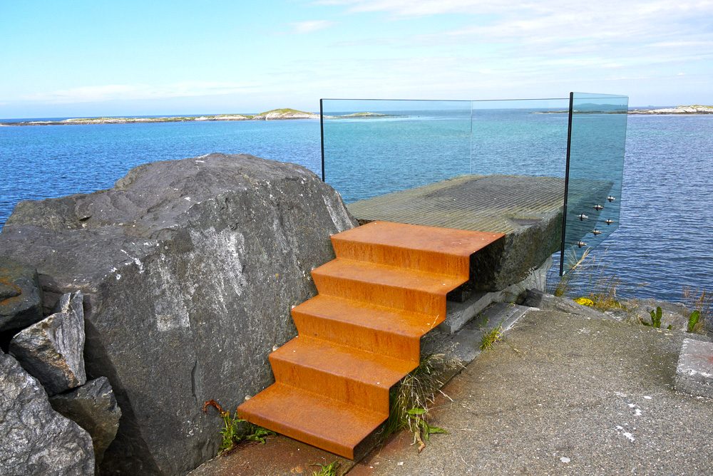
Located at the western end of the road, this viewing platform provides a panoramic perspective of the ocean and the surrounding archipelago.
Walk to the end of the walkway for better horizon lines.
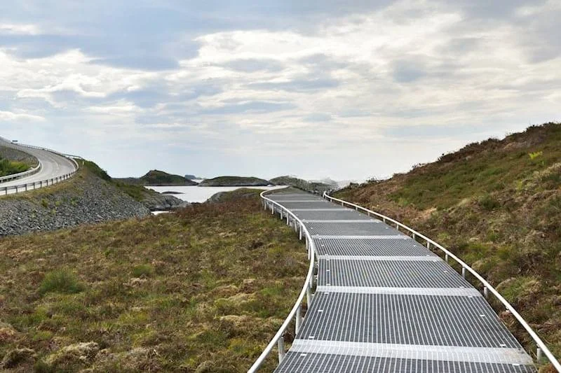
A designated stop featuring an elevated walking path that circles the island, allowing visitors to observe the terrain and bridge infrastructure.
Walk the full loop to see the bridge from beneath.
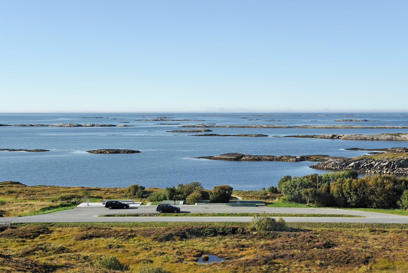
This rest area offers an expansive outlook over the Hustadvika open sea stretch and is a frequent stop for those observing changing weather patterns.
Visit during twilight for clearer silhouettes against the sea.
The Atlantic Ocean Road is situated between the coastal towns of Molde and Kristiansund, making both locations practical bases for your itinerary. Combining the coastal route with these nearby cultural and natural centers allows for a comprehensive experience of the Møre og Romsdal region.
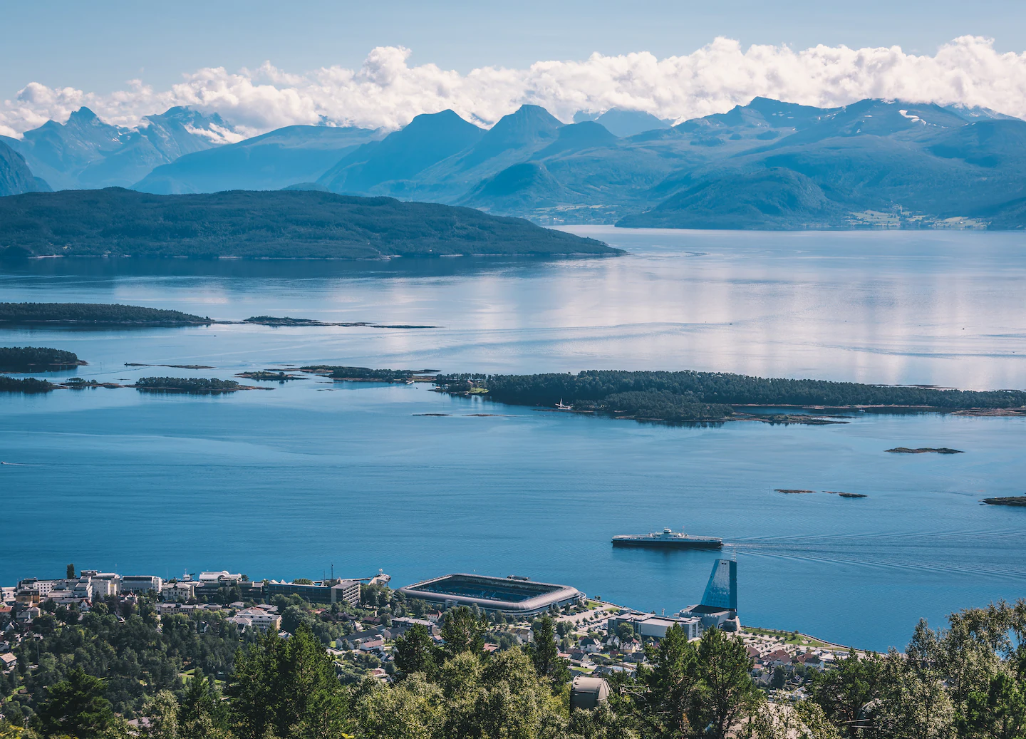
~1 hour drive
Known as the town of roses, Molde provides a convenient southern gateway with extensive lodging and dining options.
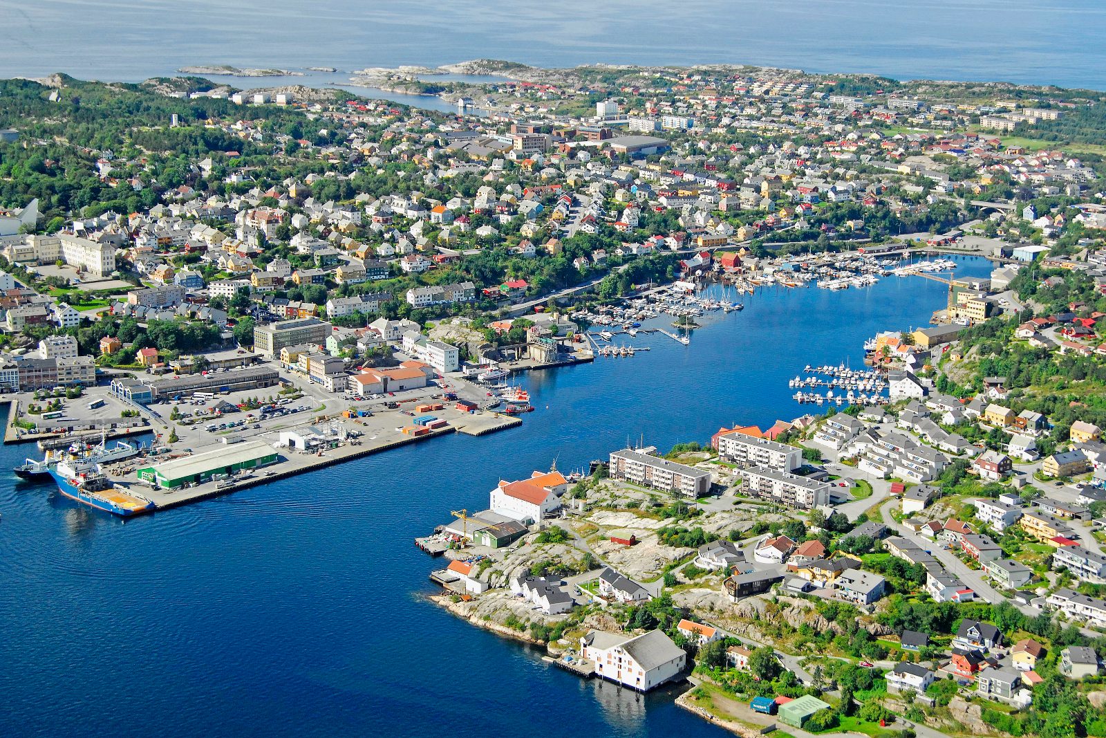
~45 min drive
Located at the northern end of the route, this town spans four islands and offers a maritime history that complements the coastal drive.
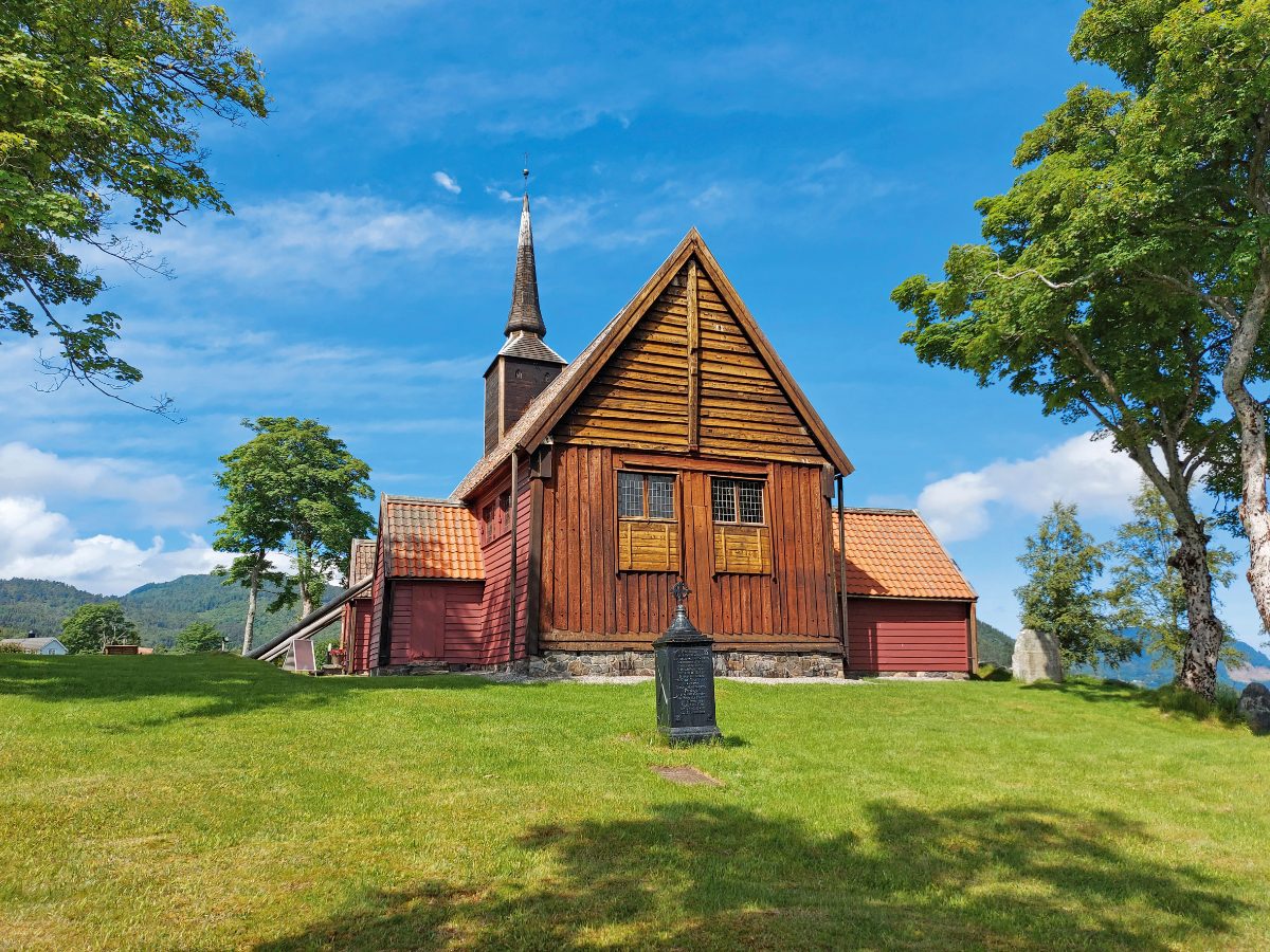
~20 min drive
This historical wooden church on the island of Averøy offers insight into local heritage just a short distance from the road.
Everything you need to know about where is the atlantic ocean road located
The Atlantic Ocean Road is situated in Norway, spanning the municipalities of Averøy and Hustadvika in Møre og Romsdal county. You can find exactly where is the atlantic ocean road located by navigating to Atlanterhavsvegen, 6530 Averøy.
Accessing this scenic Norwegian route typically involves traveling from nearby cities like Molde or Kristiansund. When considering where is the atlantic ocean road located, most visitors utilize a rental car or join a guided sightseeing tour for easier navigation along the bridges.
There is no entrance fee to access this attraction as it is a public road with no tolls. You may drive across the iconic Storseisundet Bridge without paying any admission costs.
The road operates 24/7 throughout the entire week, including weekends. This ensures that you can plan your visit at any time, as the site remains accessible at all hours.
To avoid peak traffic and enjoy optimal lighting, consider visiting during off-peak hours. Since where is the atlantic ocean road located implies a 24/7 operational window, you are free to arrive anytime between 00:00 and 23:59.
The route is open year-round, allowing travelers to experience the dramatic ocean views regardless of the season. Please check local weather reports, as coastal conditions can change quickly in this region.
Before visiting, ensure your vehicle is prepared for coastal driving conditions and check the latest traffic updates. Proper planning will help you fully appreciate the architectural design of this famous Norwegian scenic route.